Summer Reading—It's in the Maps
by Nancy Kandoian, Lionel Pincus and Princess Firyal Map Division, Stephen A. Schwarzman Building
June 29, 2020
Don't feel sheepish if someone asks what books you're reading this summer—there's more to reading than just books!
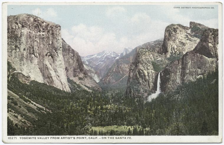
A Cartographic Escape to America's National Parks
by Nancy Kandoian, Lionel Pincus and Princess Firyal Map Division, Stephen A. Schwarzman Building
May 18, 2020
Virtual travel and time travel are at your fingertips with the remote resources of the Map Division.
Where in the World? Gazetteers and Other Place-Name Resources
by Nancy Kandoian, Lionel Pincus and Princess Firyal Map Division, Stephen A. Schwarzman Building
February 20, 2020
Resources to assist researchers and casual users find the places they are looking for.
How to Find Old Maps by Location with Map Warper
by Mishka Vance, GIS Specialist, Lionel Pincus and Princess Firyal Map Division, Stephen A. Schwarzman Building
March 14, 2019
Using the New York Public Library's Map Warper, map lovers and history buffs can find old maps by their location, and align them with present-day locations.
Using Maps for Genealogy Research, Part 1: Finding Records
by Philip Sutton, Milstein Division of U.S. History, Local History & Genealogy, Stephen A. Schwarzman Building
December 24, 2018
Did you know the Library is home to 433,000 sheet maps, and 20,000 books and atlases published between the 16th and 21st centuries? In the first of this five-part series, we review the various ways genealogists can use these maps in their research.
Using Maps for Genealogy Research, Part 2: Fire Insurance Maps - Exploring Space and Time
by Philip Sutton, Milstein Division of U.S. History, Local History & Genealogy, Stephen A. Schwarzman Building
December 24, 2018
Born of necessity, fire insurance maps can be used with other sources to create family histories with color and context. Find out more in this second part of our five-part series of genealogy research.
Using Maps for Genealogy Research, Part 3: Place of Origin and Immigration Stories
by Philip Sutton, Milstein Division of U.S. History, Local History & Genealogy, Stephen A. Schwarzman Building
December 24, 2018
Determining an ancestor's place of origin, and how they arrived in the U.S., is one of the engaging aspects of genealogy research. In this 3rd part of our five-part series, see the role that maps play in that research and follow the story of one immigrant family from Northern Italy to Iron Belt, Wisconsin.
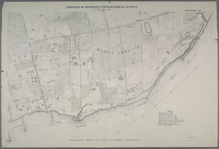
Using Maps for Genealogy Research, Part 4: Topographical Maps, and County Maps and Atlases
by Philip Sutton, Milstein Division of U.S. History, Local History & Genealogy, Stephen A. Schwarzman Building
December 24, 2018
Discover how topography can help inform your research, creating a powerful narrative that can bring the past to life. Part 4 of our five-part series.
Using Maps for Genealogy Research, Part 5: Gazetteers and Finding Maps
by Philip Sutton, Milstein Division of U.S. History, Local History & Genealogy, Stephen A. Schwarzman Building
December 24, 2018
We wrap up our five-part series with a look at the importance of gazetteers in your genealogical search, and a summary detailing how to find the maps at NYPL.
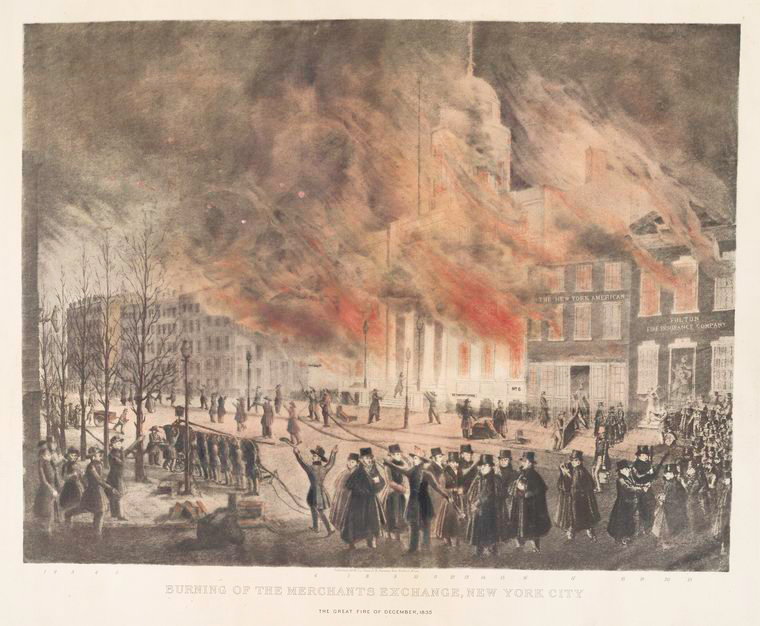
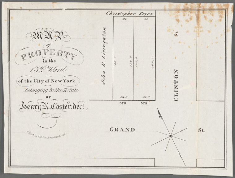
Collection of Broadside Real Estate Maps Announcing Auctions Of Lots in Early 19th Century New York City: 1832-1837
by Ian Fowler, Curator of Maps, History, and Government Information, Stephen A. Schwarzman Building
December 7, 2018
Witness the city's expansion as real estate companies promoted lot auctions north of the historical boundary of Canal Street.
Maps in the Gap: Discovering The Map Division’s Dictionary Catalog, Now Online
by Nancy Kandoian, Lionel Pincus and Princess Firyal Map Division, Stephen A. Schwarzman Building
June 1, 2018
Take a peek into the geographic past... Discover the best ways to use the catalog, and examples of what you can expect to find.
New York and the American Revolution: Resources at NYPL
by Diane Dias De Fazio
September 11, 2017
Interested in learning more about New York's role, and the early battles of the American Revolution? Inspired by Hamilton?
Pi(e) Day in the Map Division
by Nancy Kandoian, Lionel Pincus and Princess Firyal Map Division, Stephen A. Schwarzman Building
March 14, 2017
Taking inspiration from the delightful National Cookie Day post, the Map Division is using Pi(e) Day as cause to celebrate not only our love for pie (the eating kind), but also, the wonderful variety of pictorial maps in the collections of the Lionel Pincus and Princess Firyal Map Division.
Discovering Charles Minard: Information Design, Numerical Magnitudes, and a New Understanding of an Old Technique
by Margaret Pearce, Short-term Fellow
January 6, 2017
The collections of the Map Division of The New York Public Library contain a rare gem of information graphics and cartographic design: a copy of Charles Minard's self-published folio of 1861, Des tableaux graphiques et des cartes figuratives.
Digging Up the Nineteenth-Century Roots of Thematic Map Techniques
by Margaret Pearce, Short-term Fellow
December 15, 2016
The mission of my Short-Term Fellowship was to research the development of thematic map technique in the West: the way that proportional circle, flow line, isopleth, choropleth, dasymetric, dot density, and cartogram techniques were invented and developed in Europe and the United States during the nineteenth century.
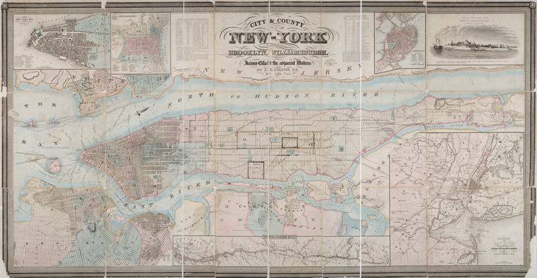
Navigating the Library's New York City Maps
by Artis Q. Wright, Specialist II, Lionel Pincus and Princess Firyal Map Division, Stephen A. Schwarzman Building
December 14, 2016
Our collection of New York City maps spans a large swath of time, tracking the growth of the city from its early days as a small North Atlantic Dutch colony to its modern incarnation as one of the capitals of the globalized world.
Citizen Cartography: No April Foolin'
by Mishka Vance, GIS Specialist, Lionel Pincus and Princess Firyal Map Division, Stephen A. Schwarzman Building
April 7, 2016
Spring has sprung and new maps have been added to the NYPL Map Warper. No joke!
Coming Soon: The Hunt-Lenox Globe, in 3D!
by Michael Inman, Susan Jaffe Tane Curator of Rare Books, Rare Book Division, Stephen A. Schwarzman Building
January 29, 2016
The New York Public Library received a generous grant from the Samuel H. Kress Foundation to scan the globe using 3D imaging technology. The project was undertaken in conjunction with the Lazarus Project, an organization that provides historical researchers access to advanced imaging technology.
The Bronx in the Public Domain
by Jean Harripersaud, Bronx Library Center
January 22, 2016
Did you know that out of 180,000 public domain images, over 2,000 are from the Bronx? This post will highlight some the treasures from this incredible gold mine of historic images that are now free to use.
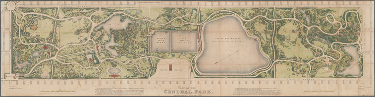
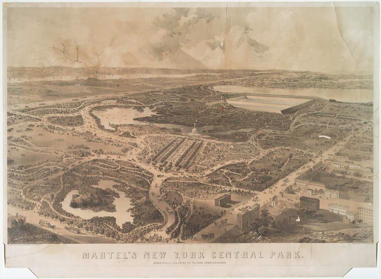
Historic Central Park Maps
by Artis Q. Wright, Specialist II, Lionel Pincus and Princess Firyal Map Division, Stephen A. Schwarzman Building
July 6, 2015
The Library's collection includes a diverse range of cartographic material including well-known topographic surveys depicting the landscape before the park’s construction as well as numerous maps published after its completion with indexes that list amenities and places of interest.


 With your library card, it's easier than ever to choose from more than 300,000 e-books on SimplyE, The New York Public Library's free e-reader app. Gain access to digital resources for all ages, including e-books, audiobooks, databases, and more.