New York and the American Revolution: Resources at NYPL

This week in history we remember three major events in the early American Revolution: the Staten Island Peace Conference (September 11), the British Landing at Kips Bay (September 15), and the Battle of Harlem Heights (September 16). Bringing the past into your feed in real time last month, the Irma and Paul Milstein Division of United States History, Local History and Genealogy chronicled events from the Battle of Long Island (August 22-30, sometimes also known as the "Battle of Brooklyn") in 140 characters or fewer—as tweets under #BattleOfLI.

Interested in learning more about New York's role, and the early battles of the American Revolution? Inspired by Hamilton? Here are some of the resources I consulted when pulling the #BattleOfLI series together.

(Links connect to NYPL catalog record and NYPL Digital Collections, unless otherwise noted.)

Books

1776 cover image

The American journal of Ambrose Serle, secretary to Lord Howe, 1776-1778, edited with an introduction by Edward H. Tatum, jr.

A Hessian officer's diary of the American Revolution / translated and edited by Bruce E. Burgoyne.

 The campaign of 1776 around New York and Brooklyn.

The American rebellion; Sir Henry Clinton's narrative of his campaigns, 1775-1782, with an appendix of original documents. Edited by William B. Willcox.

Redcoat : the British soldier in the age of horse and musket / Richard Holmes.

Letters from America, 1773-1780; being the letters of a Scots officer, Sir James Murray, to his home during the war of American independence. Edited by Eric Robson.

Rebels and redcoats [by] George F. Scheer and Hugh F. Rankin.

The Hessians : mercenaries from Hessen-Kassel in the American Revolution / Rodney Atwood.

Memoir of a Revolutionary soldier : the narrative of Joseph Plumb Martin

cover, historical atlas book

1776. David McCullough.

The historical atlas of New York City : a visual celebration of nearly 400 years of New York City's history / Eric Homberger ; Alice Hudson, cartographic consultant.

Manuscripts and Archives

Asa Fitch transcripts of Jabez Fitch narrative and diaries, ca. 1871

Henry Knox Papers, 1779-1800 (entirely available online)

Jabez Fitch diary, Mss Coll 1016, also via Digital Collections

Nathanael Greene Miscellany, 1776-1784

Return of officers and soldiers of the Maryland troops under the command of Col. Smallwood, killed and missing after the action on Long Island, Aug. 27, 1776.

Thomas Addis Emmet Collection, 1483-1876 [bulk 1700-1800] and via Digital Collections

Visual Materials

Map of Battle of Long Island

Map Division


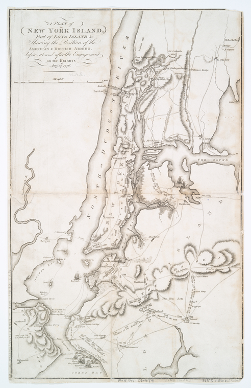
A plan of New York Island, part of Long Island &c : shewing the position of the American & British armies, before, at, and after the engagement on the Heights, Aug. 27th, 1776 [433998]

A plan of New York Island, part of Long Island, &c. : shewing the position of the American and British armies before, at, and after the engagement on the Heights, Aug. 27th, 1776. [Map Div. 01-319; digital ID: 433993]

A plan of New York Island, with part of Long Island, Staten Island & east New Jersey : with a particular description of the engagement on the woody heights of Long Island, between Flatbush and Brooklyn, on the 27th of August 1776 between His Majesty's forces commanded by General Howe and the Americans under Major General Putnam, shewing also the landing of the British Army on New-York Island, and the taking of the city of New-York &c. on the 15th of September following, with the subsequent disposition of both the armies.  [Map Div. 01-473; digital ID: 433997]

A plan of New York Island, with part of Long Island, Staten Island & east New Jersey : with a particular description of the engagement on the woody heights of Long Island, between Flatbush and Brooklyn, on the 27th of August 1776… [Map Div. 01-476; digital ID: 434000]

A plan of New York Island, with part of Long Island, Staten Island & east New Jersey : with a particular description of the engagement on the woody heights of Long Island, between Flatbush and Brooklyn, on the 27th of August 1776 between His Majesty's forces commanded by General Howe and the Americans under Major General Putnam, shewing also the landing of the British Army on New-York Island, and the taking of the city of New-York &c. on the 15th of September following, with the subsequent disposition of both the armies. [Map Div. 01-1773; digital ID: 1261077]

A plan of New York Island, with part of Long Island, Staten Island & east New Jersey : with a particular description of the engagement on the woody heights of Long Island, between Flatbush and Brooklyn, on the 27th of August 1776 between His Majesty's forces commanded by General Howe ... [Map Div. 97-6168; digital ID: 484189]

A plan of the city and environs of New York in North America.

Île de New-York, partie de Long-Island ou de l'Île Longue et positions des armées américaine et britannique après le combat livré sur les hauteurs, le 27 Août, 1776.

Map and plan to illustrate the battle of Long Island, Aug. 27th 1776

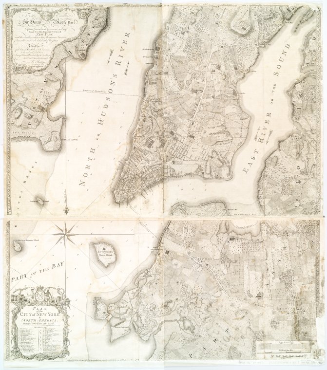
Plan of the city of New York in North America : surveyed in the years 1766 & 1767 [434801]

Ratzer Map of Manhattan and Brooklyn, 1776
Plan of the city of New York in North America : surveyed in the years 1766 & 1767 [1258618]


Plan of the city of New York in North America : surveyed in the years 1766 & 1767 [1258618]

Plan of the town of Brooklyn and part of Long Island.

Sketch of the country illustrating the late engagement in Long Island.

The seat of action between the British and American forces, or An authentic plan of the western part of Long Island, with the engagement of the 27th August 1776 between the King[']s forces and the Americans : containing also Staten Island, and the environs of Amboy and New York, with the course of Hudsons River, from Courtland, the great magazine of the American Army, to Sandy Hook [Map Div. 87-5278; digital ID: 484180]

The seat of action between the British and American forces, or An authentic plan of the western part of Long Island, with the engagement of the 27th August 1776 between the King[']s forces andthe Americans : containing also Staten Island, and the environs of Amboy and New York, with the course of Hudsons River, from Courtland, the great magazine of the American Army, to Sandy Hook.[Map Div. 97-6166 [LHS 805]; digital ID: 1166985]

Picture Collection

 passage of the troops to long island

American History -- 1776 (collection)

Battle of Long Island (Vechte Cortelyou house)

Bedford Corners, Brooklyn, 1776

Howard's Inn, 1776. From which the guides of the flanking detachment of the British were taken.

Landing of the British forces in the Jerseys, November, 20, 1776.

Lord Stirling Last Struggle Around The Old Cortelyou House.

New York City -- Brooklyn — 1899 & earlier (collection)

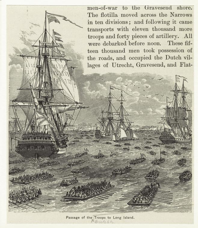
Passage of the Troops to Long Island (also in the Picture Collection Online)

The Battle of Long Island

The Brooklyn Church, and Duffield House, 1776, Fulton Avenue, between Bridge and Lawrence Streets.

"The Retreat from Long Island"

View from Gowanus Heights, Brooklyn

Washington's Retreat at Long Island

Print Collection

Illustration of ships in the harbor

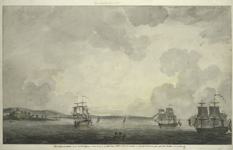
An original sketch by an English officer on board of one of Adml. Howe's Fleet while at anchor in New York Harbor, just after the Battle of Long Island

Battle of Long Island, Retreat of the Americans under Gen. Stirling acorss Gowanus Creek

Denyse's Ferry, the first place at which the Hessians and British landed on Long Island Aug. 22nd 1776.

General Putnam

Lord Stirling at the battle of Long Island

Marquis Charles Cornwallis

The Battle Pass (in Prospect Park, Brooklyn)

View from Battle Hill [Long Island]

Online Resources

Conference House from Milstein Division Collections
The Conference House , Staten Island. Images via NYPL Digital Collections, #729014F and #729011F.

The London chronicle [electronic resource].

NYPL Map Warper

OldNYC.org (photos of locations from NYPL Digital Collections)

Personal recollections of Captain Enoch Anderson. (via FamilySearch.org)