Historic Central Park Maps
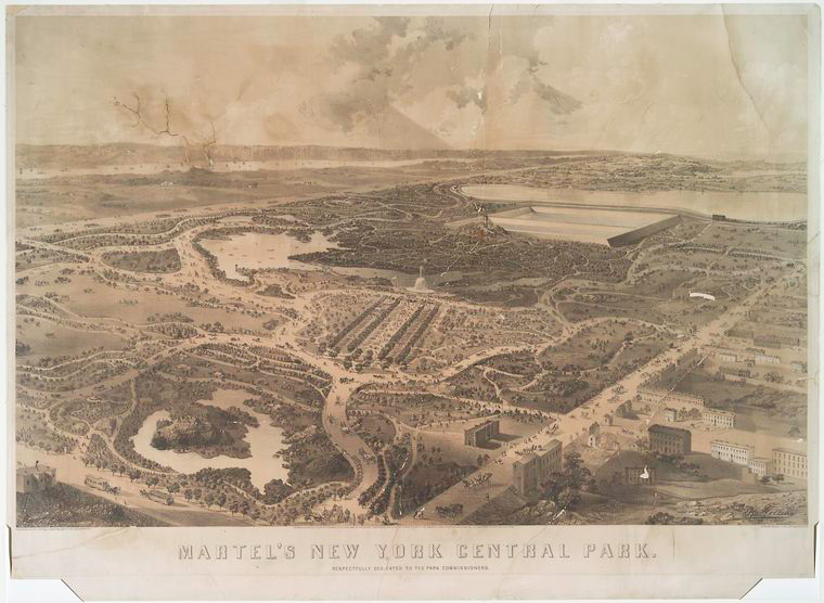
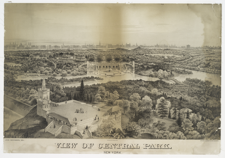
I recently completed a project in which I had the pleasure of cataloging a large number of NYPL’s historic maps of Central Park. Several of these maps were produced while the park was still under construction depicting the progress of the hundreds of workers who helped transform a rural section of the island of Manhattan that once included swamps, stony ridges and stable working class communities (such as Seneca Village) into Frederick Law Olmsted and Calvert Vaux’s rus in urbe masterpiece. The collection includes a diverse range of cartographic material including well-known topographic surveys depicting the landscape before the park’s construction as well as numerous maps published after its completion with indexes that list amenities and places of interest.

Although the majority of the maps in the collection are in a sense “tourist maps,” designed to be used by the general public, a small number were created with a more specific audience in mind. Map of the Central Park: Printed for the Department of Public Parks is a recent acquisition and is a great example of a map in which the intended user was not a day-tripper but the scores of landscapers, gardeners and laborers responsible for the monumental task of irrigating, pruning and seasonal care of the park’s various types of vegetation. Part of what makes this color map so unique is its size, 49 x 182 cm (approximately 1½ feet tall and 6 feet wide) and its large 1:2,400 scale. The grand scale and format enabled map maker Otto Sibeth, the department’s “chief draughtsman” (who is recorded as earning $100 per month in 1878!) to add plenty of detail to this beautiful rendering of one of the city’s most cherished landmarks.

Like most Central Park maps, Sibeth’s shows the roads, bridle paths, bridges, trails and trees but his map also includes something unique—a lightly rendered 100 square foot grid underlay by which readers can use a 42 page detailed index, Central Park, the plant list of 1873, prepared by Robert Demcker landscape architect, to determine “the position of one or more specimens of 642 species and varieties of hardy trees and shrubs;... also of 361 perennial and alpine plants in the open ground and of 551 in the nursery and exotic collection” all of which were planted in the park’s original 864 acres. Sibeth’s map does not include a date of production, however most map librarians estimate it was created between the years of 1871 and 1874 due to the fact that it depicts the vacant sites of the Metropolitan Museum of Art and the American Museum of Natural History.

Sibeth’s map also depicts a “temporary menagerie” along 5th Avenue in front of the Arsenal at East 64th St. even though Olmsted and Vaux’s original design, also know as the “Greensward Plan,” did not include a site for a zoo. In Roy Rosenzweig's and Elizabeth Blackmar’s The Park and the People, a comprehensive account of the social and political wrangling that led to the park's creation and subsequent use, the authors describe how soon after the park’s opening New Yorkers of all stripes quickly started donating what Olmsted characterized as “pets of children who had died” or had left town. While it is unclear if his observations were accurate or simply a bit of sardonic wit, what is clear is that by 1865 more than 250 animals had been bequeathed to the park’s board of commissioners including alligators, white mice, turkeys, a pelican, a domestic goat, a humped camel, bald eagles, foxes, yellow crested cockatoos, black bears and three ringtail monkeys. (See the board’s 1865 Annual Report for a complete list.) A makeshift zoo was hastily constructed at the old Arsenal Building, however several “concerned citizens” (among which I assume were more than a few 5th Ave. homeowners who lived downwind of the zoo) objected to having the menagerie at this location and pushed the city to build a permanent location in which to house the growing assortment of mammals, reptiles, amphibians and wild birds at another location within the park.

Proposed location of Zoological Collections, an unsigned and undated manuscript map in the Map Division’s Central Park collection, may possibly be an example of such a plan. The hand colored map is 127 x 96 cm and depicts a zoo in the area where the Central Park Tennis Center now stands, bounded by the 97th St. transverse, 8th Avenue, 91st St. and the reservoir. The map includes renderings of sites that would house a wide variety of animals including elephants, sea lions, prairie dogs, deer, ostriches, buffalos, bisons, antelope, giraffes, pigeons (!?!), owls and “carnivora.” All of the animal houses encircle a large structure labeled “Refreshment Building” where presumably zoo patrons could consume a small snack or drink while contemplating the wonders of the natural world. The Dictionary catalog of the Map Division lists [1885?] as the publication date for this manuscript map which seems probable given that the commissioners were most likely considering several design schemes during the years preceding 1887 when Governor David B. Hill vetoed a bill passed by the New York State legislature that would have provided funds to the Board of Commissioners of Central Park for the explicit purpose of relocating the zoo to another site within the park.
![Detail from [Plan of the part of Central Park showing the location of Croton Aqueduct water pipes and transverse road no.4] Detail from [Plan of the part of Central Park showing the location of Croton Aqueduct water pipes and transverse road no.4]](https://live-cdn-www.nypl.org/s3fs-public/21.jpg)
“Proposed location of Zoological Gardens,” which is really more of a plan than a map, not only shows potential locations of the zoo’s wildlife it also includes schematic drawings of the subsurface water pipes that would make up the zoo’s general plumbing. Which leads to another mysterious manuscript map in NYPL’s Central Park collection not intended for general use and of which the name of the mapmaker, publication date and title is not known. The Dictionary Catalog of the Map Division's bibliographic entry lists a publication date of [1870?] and the librarians who were the first to catalog this map in the early 1900s gave it the prosaic title [Plan of the part of Central Park showing the location of Croton Aqueduct water pipes and transverse road no. 4] for that is exactly what it portrays. The 79 x 150 cm map is in pen and ink on cloth mounted on muslin and depicts the area of the park bounded by 93rd St., 8th Ave., 97th St. and 5th Ave. It shows the location of several of the three foot wide “Croton pipes” water mains that feed the reservoir through the North Gate House as well as the smaller vitrified clay and cement water pipes with diameters ranging from four inches to one foot that supplied water from the reservoir to the rest of the city and helped irrigate the lawns and gardens of Central Park. Completed in 1862, the 106 acre, one billion gallon distributing reservoir served the people of New York for more than 130 years before it was decommissioned in 1993.
For a complete list of all of the historic (and not so historic) Central Park sheet maps available for viewing at the Map Division search NYPL’s online catalog using the keyword search term “Central Park map”, a few of my favorites that may also be viewed online in the Digital Collection include:
- Central Park (1863) / John Bachmann
- Central Park New York: A Picturesque Guide To All The Improvements Up To June 1865 / L. Prang & Co.
- Central Park: Memorial Of The Common Council Of The City Of New York To The Legislature (1853)
- Insurance Map of New York, Manhattan vol. 6 plate 70 (1884-1907) / Sanborn Map Company
- Map Of The Lands Included In Central Park, From A Topographical Survey (1853) / Egbert L. Viele
Read E-Books with SimplyE
 With your library card, it's easier than ever to choose from more than 300,000 e-books on SimplyE, The New York Public Library's free e-reader app. Gain access to digital resources for all ages, including e-books, audiobooks, databases, and more.
If you don’t have an NYPL library card, New York State residents can apply for a digital card online or through SimplyE (available on the App Store or Google Play).
Need more help? Read our guide to using SimplyE.


Comments
Central Park
Submitted by Val Crotty (not verified) on July 31, 2015 - 1:16am
Central Park plans
Submitted by Lorna McNeur (not verified) on December 30, 2018 - 11:56am