Collection of Broadside Real Estate Maps Announcing Auctions Of Lots in Early 19th Century New York City: 1832-1837
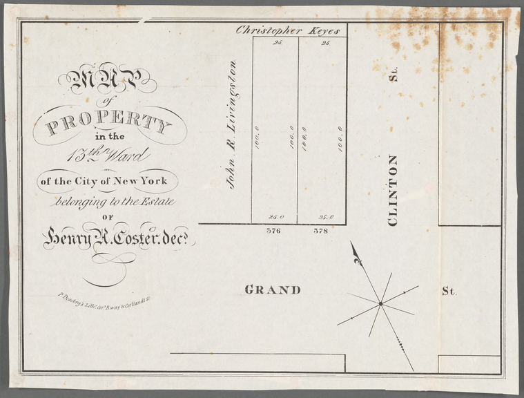
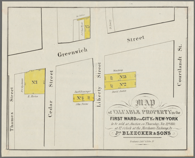
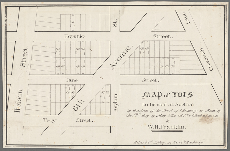
This collection of real estate maps of lots in early-19th century lower Manhattan are from auctions conducted by James Bleecker & Sons, Franklin & Jenkins, and others. Published as broadsides—that is maps printed only on one side which served as promotional tools for real estate auction houses—they are organized in groups by neighborhood: the Financial District; Greenwich Village, East Village (including New York University); the West Village; SoHo & TriBeCa; and, the Lower East Side. These maps show the massive change in land ownership and the organization of Manhattan in the early 19th century.
In 1825, the Erie Canal opened and with it came a new wave of development and expansion in New York City. As trade and commerce expanded during the following period, the population doubled almost every decade. These changes meant the built environment of the city needed to expand north beyond its historical boundary, Canal Street.
These broadside maps were produced by the foremost real estate auction companies of the 1830s, to advertise and document the sale of land in the city during this property boom. They demonstrate, in great detail, how large Revolutionary War-era estates of families such as the Minards, Gilberts, and Costers were parceled out into blocks of townhouses. These maps also provide us with some of the most detailed print records of land ownership throughout lower Manhattan for this time.
These broadside maps are extremely important documents for showing not only how New York City dealt with such massive increases in population, but also how the Commissioners’ Plan of 1811 to grid the city was expanded below Houston Street. This collection of maps works in concert with other collections at the Library related to city planning on Manhattan from 1807 to the early 1820s, as well as the maps of 18th century farmland on the island that were produced by John Bute Holmes in the late 19th century.
In addition to these resources, this collection of real estate maps speaks to many prominent landowners in Manhattan from the Revolutionary War-era, whose lives are well-documented by primary source materials in the Manuscripts and Archives Division.
More detailed information about this collection is available through the NYPL Archives and Manuscripts Portal and NYPL Online Catalog The digitized collection can be viewed through the NYPL Digital Collections.
Related NYPL Research Collections:
- Bancker plans (1667-1821)
- Real estate survey books (1826-1851)
- Broadside real estate Maps (1832-1837)
- NYC land auction catalogs (1860s – 1920s)
- NYC fire insurance, topographic and property maps (1850s to the present)
Read E-Books with SimplyE
 With your library card, it's easier than ever to choose from more than 300,000 e-books on SimplyE, The New York Public Library's free e-reader app. Gain access to digital resources for all ages, including e-books, audiobooks, databases, and more.
If you don’t have an NYPL library card, New York State residents can apply for a digital card online or through SimplyE (available on the App Store or Google Play).
Need more help? Read our guide to using SimplyE.