Navigating the Library's New York City Maps
NYPL's Lionel Pincus and Princess Firyal Map Division is home to almost half a million maps and approximately 20,000 atlases. Our collection of New York City maps spans a large swath of time, tracking the growth of the city from its early days as a small North Atlantic Dutch colony to its modern incarnation as one of the capitals of the globalized world. Wading through NYPL's large NYC map collection and locating the maps and or atlases that will satisfy your curiosity or support your research may at first seem like a difficult task. This blog will familiarize readers with three types of maps in our collection most often used to depict NYC—street maps, fire insurance maps, and thematic maps.
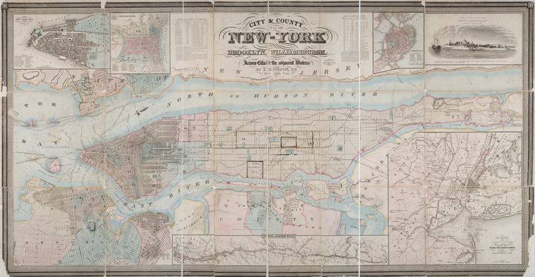
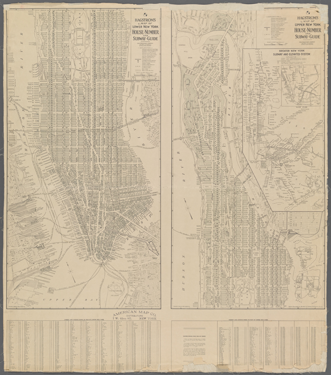
Most readers are familiar with the most common map type—the street map. Maps that focus on NYC's streets, avenues, expressways, etc. are by far the most numerous type of NYC map in our collection. These maps were designed to help the user locate institutions, public buildings, places of worship, large commercial and residential buildings. In addition to depicting the location of these spaces (as well as their relationship to one another) many street maps also include building address ranges, political boundaries (e.g. ward and election boundaries) and, most importantly, street names. View some of our historic maps.
The Map Division has NYC street maps from the colonial period to the present that are stored by borough and date depicted. It's important to keep in mind that many of our antiquarian maps do not appear in NYPL's online catalog, be sure to consult the Dictionary Catalog of the Map Division (Map Div. has a copy of the set in room 117) or seek the assistance of a map librarian. We also have a large selection of reference books that focus on the history of NYC maps, the evolution of the city's street names and several city guides from the 19th century to the present. Four of my favorites include:
A Guide to Historical Map Resources for Greater New York by Jeffrey A. Kroessler
Mapping New York by Robert Neuwirth and Seth Robbins
Manhattan in Maps, 1527-1995 by Paul E. Cohen and Robert T. Augustyn
Naming New York: Manhattan Places & How They Got Their Names by Sana Feirstein
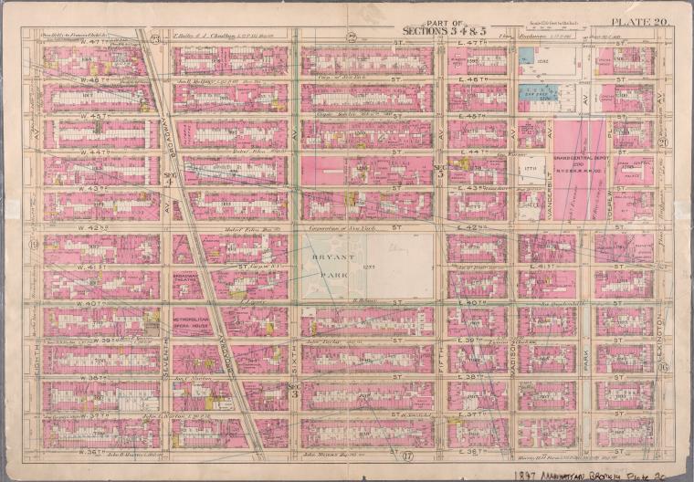
NYC street maps may depict the entire city, a borough and or a single neighborhood. Their focus on the city's main transportation corridors—the streets—and major places of interest necessitate such a broad view, leaving little room for more detailed information about the homes, offices, churches, etc. that make up a city. For this information researchers must turn to another popular urban map type—fire insurance maps. Fire insurance maps, more commonly known as “Sanborn maps” or simply “Sanborns,” are sheet maps or atlas maps which were designed to describe the built environment of a city. Unlike street maps, the makers of fire insurance maps go to great lengths to describe the buildings, the property and the transportation infrastructure that existed above, below and between a city's streets.
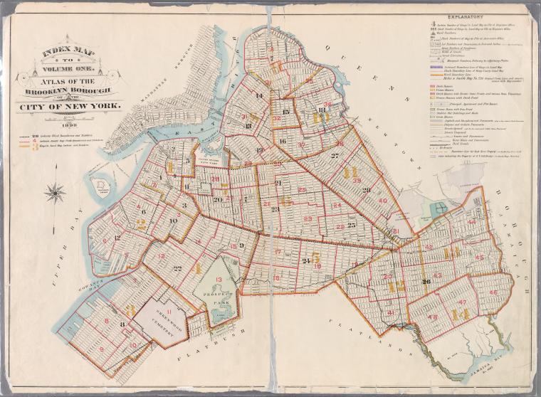
The NYC fire insurance maps in our collection were made by a variety of map companies that were staffed by dozens of surveyors, draftsman and lithographers. Most of these companies were based here in NYC or in Philadelphia and published thousands of map plates starting in the late 19th century. Some of the more prodigious and better known companies represented in NYPL's fire insurance map collection include E. Robinson and Co., Perris & Brown Map Co., G.W. Bromley and Co. and the E. Belcher Hyde Map Co. However, over time most of these companies would be absorbed by the Sanborn Map Co. which is the origin of the “Sanborn” synecdoche. Today the Sanborn Map Company copyright is owned by Environmental Data Resources Inc. Newly updated fire insurance map atlases of New York City's five boroughs are published every few years.
Although NYPL's 19th and 20th century collection of NYC fire insurance maps were made by a variety of companies they all attempt to describe the city's built environment as it was at the time of the atlas' printing. The map makers used various colors, symbols, script fonts and notations to depict construction material, fenestration, building height, block & lot dimensions, location of easements, chimneys, skylights, and many more architectural details. Some fire insurance maps include detailed information of city infrastructure such as the location of transit stations, railroad tracks, fire hydrants, sidewalk width, public parks, public institutions, places of worship, schools, colleges, industry and commercial buildings. Contemporary Sanborn maps also show old farm line boundaries and colonial roads that predate NYC's current street grid system.
Map Division staff can locate the fire insurance map plate(s) depicting your building quickly if you know the block & lot number assigned to it. Some of our NYC fire insurance atlases have been digitized. The library also has a subscription to the Digital Sanborn Maps, 1867-1970 database which includes fire insurance maps of cities, towns & villages in New York, New Jersey and Connecticut. For more information on how to accurately read Sanborn maps or to gain a better understanding of the history of this valuable historical research tool consult the following reference books:
Description and Utilization of the Sanborn Map by Sanborn Map Co.
Fire Insurance Maps: Their History and Application by Diane L. Oswald
Fire Insurance Maps in the Library of Congress
Union list of Sanborn fire insurance maps held by institutions in the United States and Canada by R. Philip Hoehn
NYPL's extensive collection of NYC fire insurance maps and street maps can help researchers document the city's built environment from the mid 17th century to the present. However, to gain a better understanding of the city's changing population demographics, the environment and or land use, readers must consult a third map type—the thematic map. In the introduction to his book Principles of Thematic Map Design, author Borden D. Dent remarks:
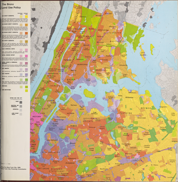
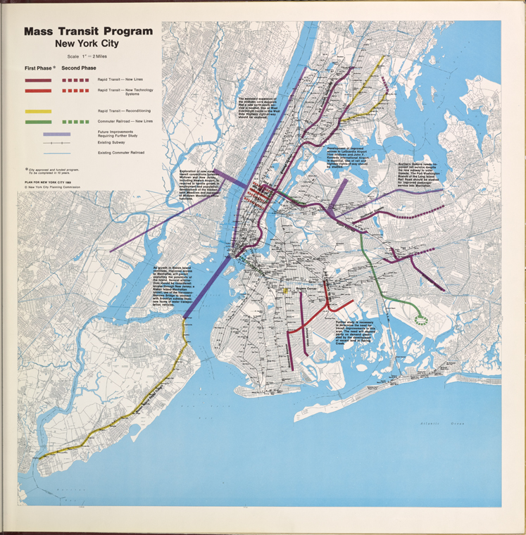
The International Cartographic Association defines the thematic map this way: "A map designed to demonstrate particular features or concepts. In conventional use this term excludes topographic maps." The purpose of all thematic maps is to illustrate the "structural characteristics of some particular geographical distribution." This involves the mapping of physical and cultural phenomena or abstract ideas about them. Structural features include distance and directional relationships, patterns of location, or spatial attributes of magnitude change. A thematic map, as its name implies, presents a graphic theme about a subject.
Or stated more simply, Wikipedia defines a thematic map as a “type of map or chart especially designed to show a particular theme connected with a specific geographic area. These maps can portray physical, social, political, cultural, economic, sociological, agricultural, or any other aspects of a city…” As both of these definitions suggest the Map Division's collection of NYC thematic maps cover a broad variety of themes and subject areas. A simple way to determine the range of themes is by consulting the New York City author headings in the Dictionary Catalog of the Map Division. Some of the more useful author headings include: City Planning Department, Education Board and Parks Department. The following NYC demographic titles are also worth mentioning:
New York City in the 1980's: a social, economic, and political atlas by John H. Mollenkopf
Plan for NYC 1969: A Proposal by City Planning Commission
Negro and Puerto Rican Populations of New York City in the Twentieth Century by Nathan Kantrowitz
As always, if you are unable to locate a thematic map, street map or fire insurance map in the dictionary catalog or NYPL's online catalog that supports your research consult a map librarian at the Map Division reference desk or send an email to maps@nypl.org.
Read E-Books with SimplyE
 With your library card, it's easier than ever to choose from more than 300,000 e-books on SimplyE, The New York Public Library's free e-reader app. Gain access to digital resources for all ages, including e-books, audiobooks, databases, and more.
If you don’t have an NYPL library card, New York State residents can apply for a digital card online or through SimplyE (available on the App Store or Google Play).
Need more help? Read our guide to using SimplyE.
