Doc Chat Forty-Two: The Brooklyn Battery Bridge and the Fight to Save New York
by Julie Golia, Curator of History, Social Sciences, and Government Information, Stephen A. Schwarzman Building
February 17, 2022
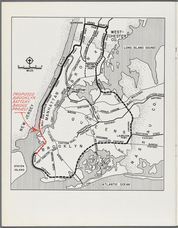
In this episode, NYPL curators Ian Fowler and Julie Golia examined maps proposing the construction of the Brooklyn Battery Bridge, a development project that would have decimated the built environments of downtown Manhattan and South Brooklyn, and that helped spark the city's modern preservation movement.
Doc Chat Episode Thirty-Three: The 1811 Plan for Manhattan, a Treasure of the New York Public Library
by Julie Golia, Curator of History, Social Sciences, and Government Information, Stephen A. Schwarzman Building
October 28, 2021
In Episode Thirty-Three, NYPL’s Sara Spink and Ian Fowler discussed the 1811 Commissioners’ Map and Survey of Manhattan Island, featured in the Library’s newly opened The Polonsky Exhibition of The New York Public Library’s Treasures.
Conservation Treatment of Hendrick Doncker’s Zee-atlas from 1660; Or, How an Atlas Gets Stressed, and What Book Conservators Do About It
by Ursula Mitra, Senior Book Conservator
September 28, 2021
The primary goal of treatment was to reinforce the maps’ attachment to the book which had begun to tear over the years.
Maps, Wayfinding, and the Discovery of Longitude
by Mishka Vance, GIS Specialist, Lionel Pincus and Princess Firyal Map Division, Stephen A. Schwarzman Building
June 18, 2021
The discovery of an accurate and reliable method of determining longitude took four centuries of study. Without this and other innovations in pre-modern navigation, we’d be lost.
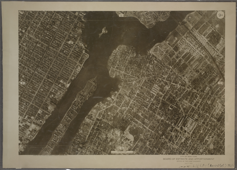
Doc Chat Episode Twenty: Aerial Photography in Focus
by Julie Golia, Curator of History, Social Sciences, and Government Information, Stephen A. Schwarzman Building
April 5, 2021
In this episode, NYPL’s Ian Fowler and Elizabeth Cronin revealed the cultural and technological origins of aerial photography, analyzed several examples, and provided historical context for its use in exploration, the military, mapmaking, and more.
NYPL's Alice Hudson: Charting a New Course for the Map Division
by Kate Cordes, Associate Director of Reference and Outreach, Humanities and Social Sciences Research Divisions, Stephen A. Schwarzman Building
March 22, 2021
Hudson joined The New York Public Library in 1970 as a Map Cataloger and Reference Librarian, and by the end of her tenure in 2009 had changed the landscape of map librarianship forever.
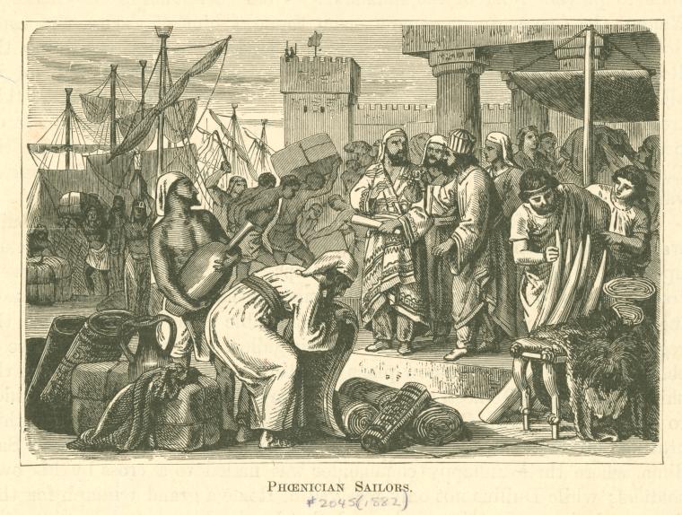
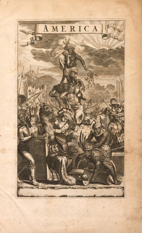
Doc Chat Episode Fifteen: Exploitative Depictions of the Americas
by Julie Golia, Curator of History, Social Sciences, and Government Information, Stephen A. Schwarzman Building
March 1, 2021
This week NYPL's Ian Fowler and Camilla Townsend, Distinguished Professor of History at Rutgers University, analyzed John Ogilby's 1671 atlas of the Americas that depicted Indigenous peoples and lands along with fantastic elements like fictional beasts.
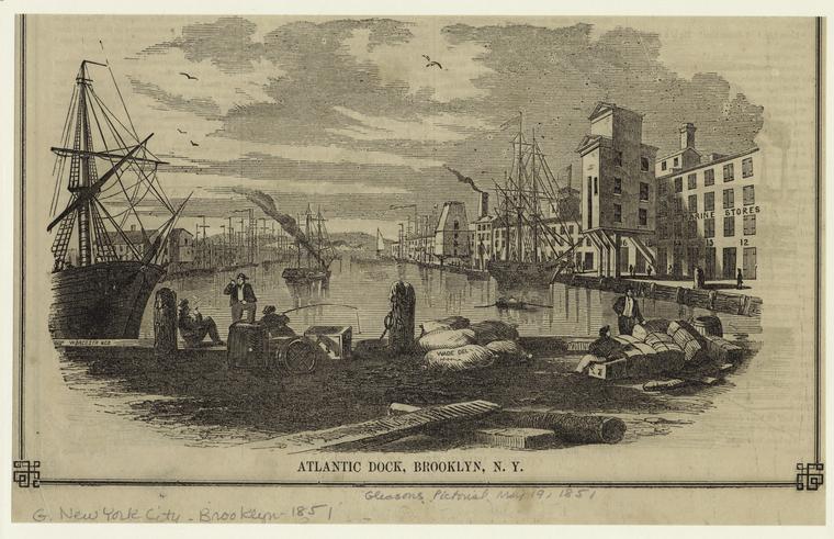
Doc Chat Episode Ten: Along Brooklyn's Industrial Waterfront
by Julie Golia, Curator of History, Social Sciences, and Government Information, Stephen A. Schwarzman Building
December 11, 2020
In this episode, NYPL curators Ian Fowler and Julie Golia analyzed maps, illustrations, and other primary sources from NYPL’s collections to look at the transformation of Brooklyn’s waterfront economy and built environment
Work/Cited Episode 2: Exploring Indigenous Ecologies and New York City's Built Environment with the Welikia Project
by Ian Fowler, Curator of Maps, History, and Government Information, Stephen A. Schwarzman Building
December 7, 2020
In this episode, NYPL's Ian Fowler was joined by Eric Sanderson, author of The Welikia Project. They discussed how this project builds on his past work, 'Mannahatta: A Natural History of New York City', and how the original ecology of the city has changed and its impact on our modern built environment.
Summer Reading—It's in the Maps
by Nancy Kandoian, Lionel Pincus and Princess Firyal Map Division, Stephen A. Schwarzman Building
June 29, 2020
Don't feel sheepish if someone asks what books you're reading this summer—there's more to reading than just books!
Teaching American History With NYPL Digital Collections: Revolutionary New York
by Julie Golia, Curator of History, Social Sciences, and Government Information, Stephen A. Schwarzman Building
June 11, 2020
The NYPL has a bevy of resources to support students and educators on this journey.
10 Books for Map Enthusiasts to Read at Home
by Nancy Kandoian, Lionel Pincus and Princess Firyal Map Division, Stephen A. Schwarzman Building
June 3, 2020
Who knew maps were so fascinating? (We did.)
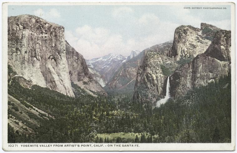
A Cartographic Escape to America's National Parks
by Nancy Kandoian, Lionel Pincus and Princess Firyal Map Division, Stephen A. Schwarzman Building
May 18, 2020
Virtual travel and time travel are at your fingertips with the remote resources of the Map Division.
NYPL Researcher Spotlight: Dr. Katherine Parker
by Ian Fowler, Curator of Maps, History, and Government Information, Stephen A. Schwarzman Building
March 12, 2020
Every day is a surprise in the map room, she says.
Where in the World? Gazetteers and Other Place-Name Resources
by Nancy Kandoian, Lionel Pincus and Princess Firyal Map Division, Stephen A. Schwarzman Building
February 20, 2020
Resources to assist researchers and casual users find the places they are looking for.
How to Find Old Maps by Location with Map Warper
by Mishka Vance, GIS Specialist, Lionel Pincus and Princess Firyal Map Division, Stephen A. Schwarzman Building
March 14, 2019
Using the New York Public Library's Map Warper, map lovers and history buffs can find old maps by their location, and align them with present-day locations.
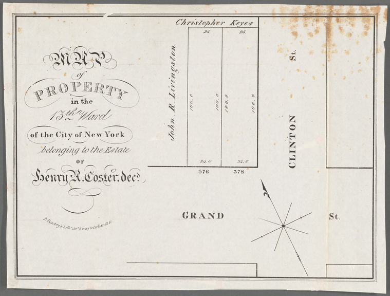
Collection of Broadside Real Estate Maps Announcing Auctions Of Lots in Early 19th Century New York City: 1832-1837
by Ian Fowler, Curator of Maps, History, and Government Information, Stephen A. Schwarzman Building
December 7, 2018
Witness the city's expansion as real estate companies promoted lot auctions north of the historical boundary of Canal Street.
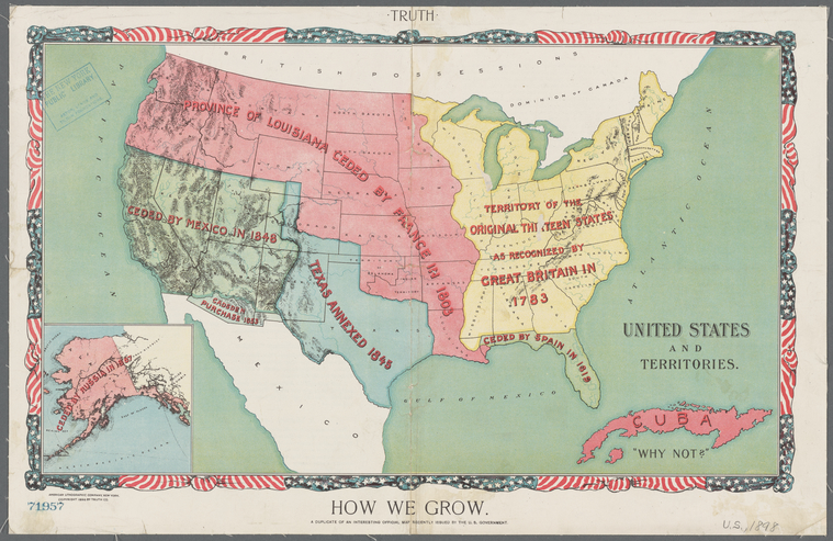
Mapping the Nation with Pre-1900 U.S. Maps: North vs South and Moving West
by Artis Q. Wright, Specialist II, Lionel Pincus and Princess Firyal Map Division, Stephen A. Schwarzman Building
June 1, 2018
In this second part of the series, we look at pre-20th century maps covering the Civil War, westward expansion, and even the World's Fairs.
Maps in the Gap: Discovering The Map Division’s Dictionary Catalog, Now Online
by Nancy Kandoian, Lionel Pincus and Princess Firyal Map Division, Stephen A. Schwarzman Building
June 1, 2018
Take a peek into the geographic past... Discover the best ways to use the catalog, and examples of what you can expect to find.
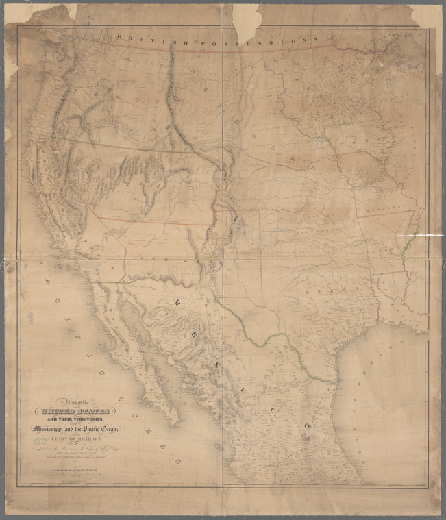
Mapping the Nation with pre-1900 U.S. Maps: Uniting the United States
by Artis Q. Wright, Specialist II, Lionel Pincus and Princess Firyal Map Division, Stephen A. Schwarzman Building
May 15, 2018
Take an extensive look at some of the most notable and influential pre-20th century maps of the U.S., and the history and mapmakers behind each one.


 With your library card, it's easier than ever to choose from more than 300,000 e-books on SimplyE, The New York Public Library's free e-reader app. Gain access to digital resources for all ages, including e-books, audiobooks, databases, and more.