Doc Chat, Research at NYPL
Doc Chat Episode Thirty-Three: The 1811 Plan for Manhattan, a Treasure of the New York Public Library
On October 7, 2021, Doc Chatters got a glimpse into one of the "Treasures" featured in The New York Public Library's new permanent exhibition.

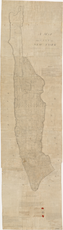
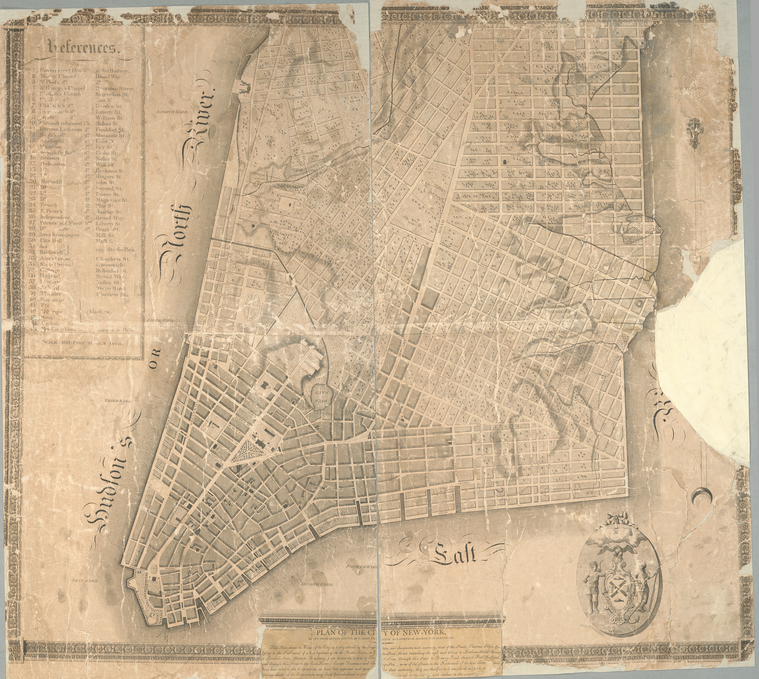
A weekly series from NYPL's Center for Research in the Humanities, Doc Chat pairs a NYPL curator or specialist and a scholar to discuss evocative digitized items from the Library's collections and brainstorm innovative ways of teaching with them. In Episode Thirty-Three, NYPL’s Sara Spink and Ian Fowler discussed the 1811 Commissioners’ Map and Survey of Manhattan Island, featured in the Library’s newly opened The Polonsky Exhibition of The New York Public Library’s Treasures, and revealed how the map laid the groundwork for the future development of the city and the transformation of the island’s geography.
Sara Spink is the Curatorial Associate for the Polonsky Exhibition of The New York Public Library’s Treasures. Ian Fowler is the Curator of Maps and Geospatial Librarian at The New York Public Library. This episode is the first of four this fall focusing on objects in the Polonsky Exhibition. Come see the exhibition in person by reserving timed tickets here.
Doc Chat Episode 33: The 1811 Plan for Manhattan, a Treasure of the New York Public Library from The New York Public Library on Vimeo.
A transcript of this episode is available here.
Below are some handy links to materials and sources suggested in the episode.
Episode Thirty-Three: Primary Sources
Sara and Ian analyzed the following maps:
Episode Thirty-Three: Primary Sources
The Museum of the City of New York, "The Greatest Grid: The Master Plan of Manhattan, 1811 - Now," exhibition, 2015.
Hilary Ballon, ed., The Greatest Grid: The Master Plan of Manhattan, 1811–2011 (Columbia University Press, 2012).
Marguerite Holloway, The Measure of Manhattan: The Tumultuous Career and Surprising Legacy of John Randel, Jr., Cartographer, Surveyor, Inventor (W. W. Norton & Company, 2014).
Gerard Koeppel, City on a Grid: How New York Became New York (Da Capo Press, 2015).
Join the Doc Chat Conversation
Doc Chat episodes take place on Zoom every Thursday at 3:30 PM. Check out upcoming episodes on NYPL's calendar, and make sure you don't miss an episode by signing up for NYPL's Research newsletter, which will include links to register. A video of each episode will be posted on the Doc Chat Channel of NYPL's blog shortly after the program. There you can also explore videos and resources for past episodes. See you at the next Doc Chat!
Read E-Books with SimplyE
 With your library card, it's easier than ever to choose from more than 300,000 e-books on SimplyE, The New York Public Library's free e-reader app. Gain access to digital resources for all ages, including e-books, audiobooks, databases, and more.
If you don’t have an NYPL library card, New York State residents can apply for a digital card online or through SimplyE (available on the App Store or Google Play).
Need more help? Read our guide to using SimplyE.