Pi(e) Day in the Map Division
by Nancy Kandoian, Lionel Pincus and Princess Firyal Map Division, Stephen A. Schwarzman Building
March 14, 2017
Taking inspiration from the delightful National Cookie Day post, the Map Division is using Pi(e) Day as cause to celebrate not only our love for pie (the eating kind), but also, the wonderful variety of pictorial maps in the collections of the Lionel Pincus and Princess Firyal Map Division.
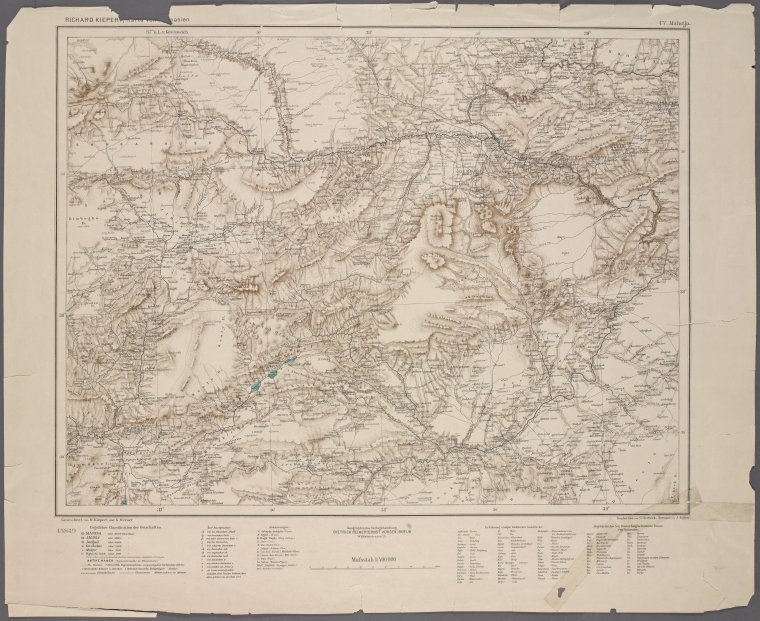
Discovering Charles Minard: Information Design, Numerical Magnitudes, and a New Understanding of an Old Technique
by Margaret Pearce, Short-term Fellow
January 6, 2017
The collections of the Map Division of The New York Public Library contain a rare gem of information graphics and cartographic design: a copy of Charles Minard's self-published folio of 1861, Des tableaux graphiques et des cartes figuratives.
Digging Up the Nineteenth-Century Roots of Thematic Map Techniques
by Margaret Pearce, Short-term Fellow
December 15, 2016
The mission of my Short-Term Fellowship was to research the development of thematic map technique in the West: the way that proportional circle, flow line, isopleth, choropleth, dasymetric, dot density, and cartogram techniques were invented and developed in Europe and the United States during the nineteenth century.
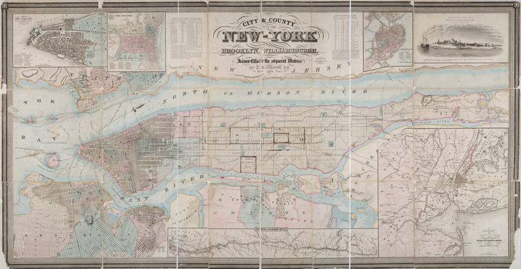
Navigating the Library's New York City Maps
by Artis Q. Wright, Specialist II, Lionel Pincus and Princess Firyal Map Division, Stephen A. Schwarzman Building
December 14, 2016
Our collection of New York City maps spans a large swath of time, tracking the growth of the city from its early days as a small North Atlantic Dutch colony to its modern incarnation as one of the capitals of the globalized world.
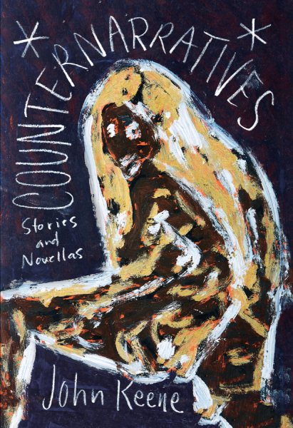
Looking for Langston, Du Bois, and Miss La La: An Interview with Author John Keene
by Artis Q. Wright, Specialist II, Lionel Pincus and Princess Firyal Map Division, Stephen A. Schwarzman Building
December 7, 2016
An interview with John Keene: a writer-in-residence in the Library’s Wertheim Study in 2013, where he researched and wrote Counternarratives, for which he received an American Book Award and a Lannan Literary Award in Fiction in 2016.
The OldNYC App Is Here! We Spoke with Its Creators
by Shana Kimball
May 4, 2016
The OldNYC experience is now available on mobile phones—discover what was there at thousands of locations across Manhattan, Brooklyn, Queens, the Bronx, and Staten Island. We talked to the developers to learn more about their work with our collections.
The Life and Strange Surprising Adventures of a Content Editor
by Arielle Landau
April 25, 2016
Nearly 300 years ago today Daniel Defoe published his tale of high-adventure, high-stakes, all-or-nothing hero Robinson Crusoe, and a classic was born. The faux travelogue captured the zeitgeist—in 1719, it seemed the whole world was up for grabs if you were just willing to get on a ship and take it. You were risking scurvy and cannibals, but think of the discoveries you could make!
Now, of course, the whole idea of "discovery" has
Citizen Cartography: No April Foolin'
by Mishka Vance, GIS Specialist, Lionel Pincus and Princess Firyal Map Division, Stephen A. Schwarzman Building
April 7, 2016
Spring has sprung and new maps have been added to the NYPL Map Warper. No joke!
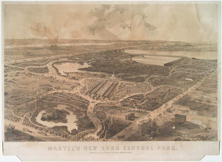
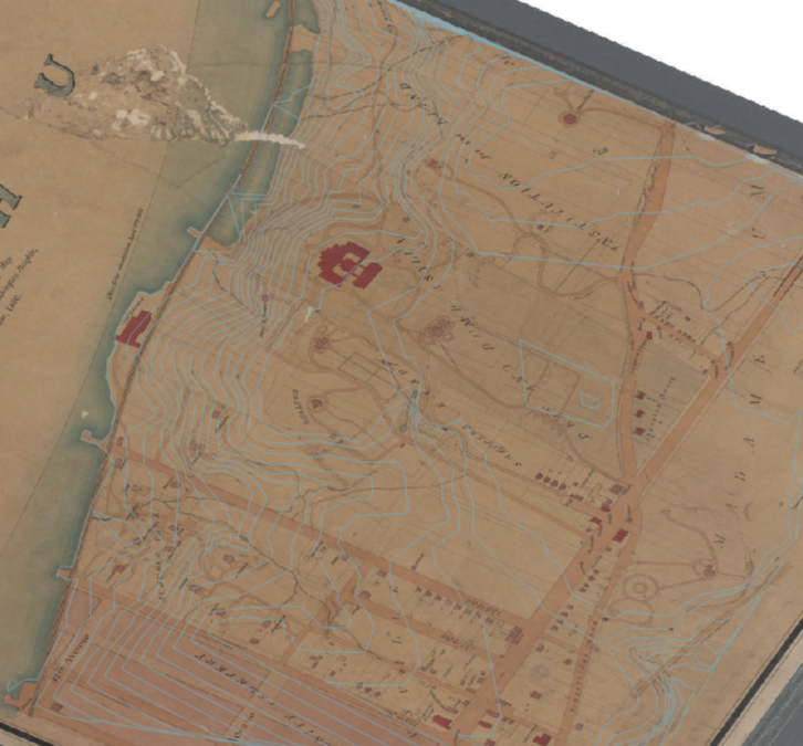
Historic Central Park Maps
by Artis Q. Wright, Specialist II, Lionel Pincus and Princess Firyal Map Division, Stephen A. Schwarzman Building
July 6, 2015
The Library's collection includes a diverse range of cartographic material including well-known topographic surveys depicting the landscape before the park’s construction as well as numerous maps published after its completion with indexes that list amenities and places of interest.
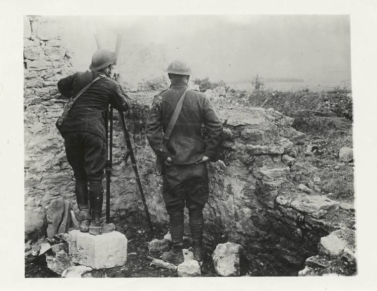
The Great War and Modern Mapping: WWI in the Map Division
by Christopher Alario
May 15, 2015
Among the hundreds of maps from the Great War, you'll find commercial maps produced for sale to the general public, pictorial propaganda maps, newspaper maps intended to illustrate the unfolding conflict, and military maps produced for a variety of purposes including training, planning offensive and defensive operations, troop dispositions and more. The languages printed on the map mirror the international range of the conflict.
Remembering Our Ancestors: Maps and Genealogy Resources for Armenian-Americans
by Nancy Kandoian, Lionel Pincus and Princess Firyal Map Division, Stephen A. Schwarzman Building
April 23, 2015
As an Armenian-American keenly aware of the devotion to lost homeland of my ethnic compatriots, I’ve always been on the lookout for Armenians among the researchers from many large ethnic groups who have found their way to the Map Division. April 24 is the 100th anniversary of the beginning of the Armenian Genocide, and one way to honor those who were not able to find refuge is to learn all we can about them and celebrate our link to them.
Du papier au Web : créez vos propres cartes interactives
by Mauricio Giraldo Arteaga
April 13, 2015
Comment créer vos propres cartes géo-référencées à l’aide d’outils Web gratuits.
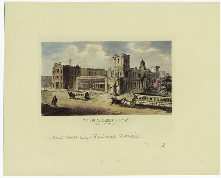
NYC Rapid Transit in Maps, 1845-1921: The Street Railroads of New York and Vicinity
by Artis Q. Wright, Specialist II, Lionel Pincus and Princess Firyal Map Division, Stephen A. Schwarzman Building
April 3, 2015
We can gain a deep understanding of the development of the city’s public transit infrastructure simply by examining nine maps published between 1845 and 1921.
Del papel a la web: haz tus propios mapas interactivos.
by Mauricio Giraldo Arteaga
February 24, 2015
Una guía para trabajar con varias herramientas web gratuitas para que puedas hacer tus propios mapas interactivos.
From Paper Maps to the Web: A DIY Digital Maps Primer
by Mauricio Giraldo Arteaga
January 5, 2015
A primer on working with various free web mapping tools so you can make your own awesome maps.
Conflict/Resolution and Changing Geographic Realities in the Peace of the Map Division
by Nancy Kandoian, Lionel Pincus and Princess Firyal Map Division, Stephen A. Schwarzman Building
December 8, 2014
Come to the Lionel Pincus and Princess Firyal Map Division to view three examples that demonstrate the role that maps play, years after their informational current-events function, in documenting histories of changing boundaries.
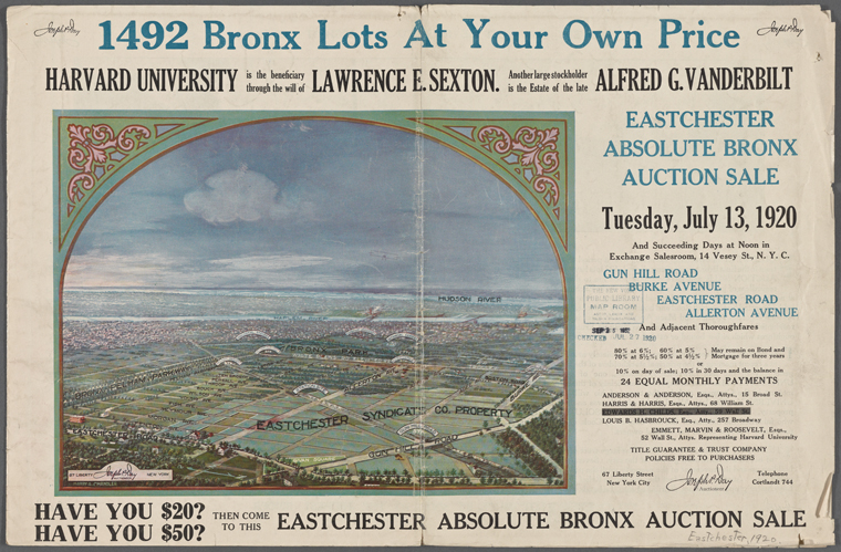
Absolute Sale! NYC Land Auction Catalogs in the Map Division
by Kate Cordes, Associate Director of Reference and Outreach, Humanities and Social Sciences Research Divisions, Stephen A. Schwarzman Building
November 20, 2014
Nearly one hundred land auctioneering pamphlets from the 1860s to 1920s and covering the Bronx, Manhattan, and Brooklyn were digitized this past year. With their richly designed covers, these promotional brochures provide modern day researchers with a window onto neighborhood development and changing patterns of land use in the city.
NYPL Labs and Map Division host first library Net Artist Residency
by Ben Vershbow
August 7, 2014
NYPL Labs is pleased to announce the Library's first-ever Net Artist Residency, in partnership with local hardware startup Electric Objects.
Peeling Off The Painted Layers of NYC Walls: Experiments With The Google Street View Archive
by Brian Foo, NYPL Labs
June 24, 2014
As a web developer who works on a screen and an illustrator that works on paper, I have always admired those who could paint big—often on impossibly large and inconveniently placed walls—only to be erased in a matter of weeks or days. The ephemeral nature of street art is what makes it simultaneously appealing and frustrating as a viewer. However, Google Maps recently rolled out a feature allowing users to go back in
Historical Maps in Minecraft
by Leonard Richardson, NYPL Labs
May 8, 2014
At a recent internal hacking event here, NYPL Labs developer Paul Beaudoin recruited me into an interesting project: transforming one of the library's 20,000 digitized historical maps into the three-dimensional world of the building game Minecraft.


 With your library card, it's easier than ever to choose from more than 300,000 e-books on SimplyE, The New York Public Library's free e-reader app. Gain access to digital resources for all ages, including e-books, audiobooks, databases, and more.