NYC Neighborhoods
Coney Island Maps
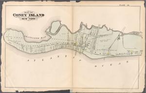
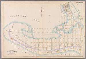
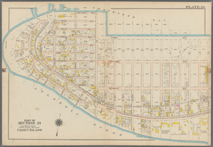
I've always been fascinated with landscapes changing through time as seen though the lens of the map. Shorelines, especially where there are lots of waves and tides, are particularly interesting things in that they are so clearly dynamic. These fire insurance maps of Coney Island, created between 1880 and 1907 document those changes beautifully. In addition to those covering Coney Island, the NYPL has digitized close to 2000 maps at this level of detail for all five boroughs of New York City.
G.W. Bromley, Atlas of the entire City of Brooklyn, 1880, Plate 35
E. Robinson, Robinson's atlas of Kings County, New York, 1890, Plate 20
G.W. Bromley, Atlas of the Borough of Brooklyn, 1907, Plate 28
Read E-Books with SimplyE
 With your library card, it's easier than ever to choose from more than 300,000 e-books on SimplyE, The New York Public Library's free e-reader app. Gain access to digital resources for all ages, including e-books, audiobooks, databases, and more.
If you don’t have an NYPL library card, New York State residents can apply for a digital card online or through SimplyE (available on the App Store or Google Play).
Need more help? Read our guide to using SimplyE.


Comments
Fascinating, too, is that
Submitted by Christopher Fahey (not verified) on June 14, 2008 - 7:50pm