NYPL Labs
NYPL Labs Building Inspector: No Sleep Til Brooklyn, API, and Open Source Edition

Hooray! You did it! We did it (we're really hooked too). To celebrate the completion of the 1857 Manhattan Atlas, we've got some exciting news:
- We're heading to Brooklyn!
- We're open sourcing the Inspector!
- There's now an API!
Brooklyn
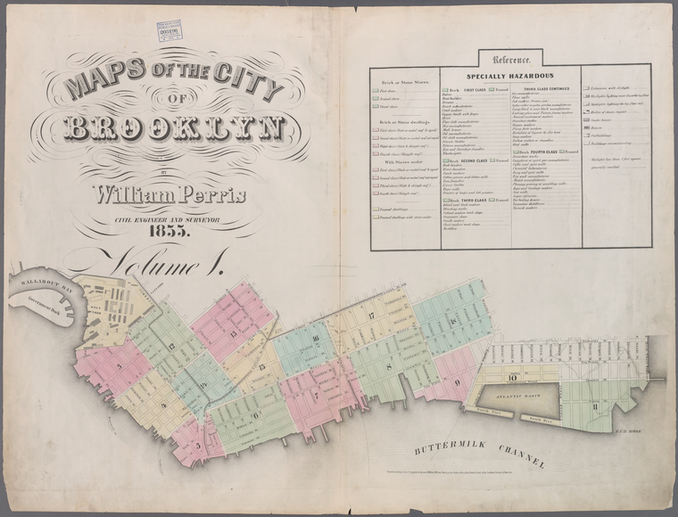
We've always had a soft spot for Brooklyn; maybe it's our long-standing crush on the Brooklyn Public Library or our love of artisanal data. No matter the reasons, this 1855 William Perris Maps of the City of Brooklyn is our next Building Inspector challenge.
Not only does this give us another 14,000 possible buildings to inspect, but it takes us back to a time before the consolidation of the City of New York where Brooklyn was its own city. The map covers the contemporary neighborhoods of DUMBO, Downtown Brooklyn, Boerum Hill, Cobble Hill, Carroll Gardens, Fort Greene, Red Hook, and parts of the Navy Yard as well as a little strip along the Williamsburg waterfront.
Open Source
We're also incredibly excited to release the Building Inspector as an open source project on Github. As with many early open source projects, it's not perfectly suited for everyone in every situation, but if you've got georectified insurance atlases that look a lot like these Perris Atlases or Sanborn Maps, try running them through the Map Vectorizer, and you can use the Building Inspector to verify the resulting polygons.
For the nerds out there who want to give it a try: it's a Ruby on Rails application that uses Postgres as a backend hosted on Heroku. Rake tasks exist to ingest the GeoJSON data produced by the Vectorizer. We host our map tiles on Amazon S3 and serve them through their CloudFront CDN (and we get them up to Amazon from the Map Warper with Mike Migurski's excellent TileStache).
If you've got any suggestions, issues, or Pull Requests—send 'em in!
API
No good super geo-nerdy toolkit would be complete without a full-fledged API, and now we have one! The Building Inspector API offers up all the polygons in glorious GeoJSON. Through this API, you're able to access the complete set of polygons by status. Full documentation is available on Github. If you're the type that likes to just dive in and figure things out, you can start playing with these links:
http://buildinginspector.nypl.org/api/polygons/yes
http://buildinginspector.nypl.org/api/polygons/yes/page/2
http://buildinginspector.nypl.org/api/polygons/no
http://buildinginspector.nypl.org/api/polygons/fix
Next week, we'll have another post explaining a little about how Building Inspector works under the hood and what happens with your inspected buildings.
Read E-Books with SimplyE
 With your library card, it's easier than ever to choose from more than 300,000 e-books on SimplyE, The New York Public Library's free e-reader app. Gain access to digital resources for all ages, including e-books, audiobooks, databases, and more.
If you don’t have an NYPL library card, New York State residents can apply for a digital card online or through SimplyE (available on the App Store or Google Play).
Need more help? Read our guide to using SimplyE.