Explore Your NYC Neighborhood...Virtually
The landscape of New York City is ever-changing—with that comes a hodgepodge of 19th century row-houses, mid-century boxy structures, glass behemoths and empty lots…often all on the same block.
It's enough to make you wonder… "what sorts of buildings were here before? What did my neighborhood used to look like?" Good news, folks—you don't necessarily need to visit the Library to find some very basic, yet fascinating information to get you started on researching your neighborhood. The answer to many questions may be found online from the comfort of your own home!
A few of these resources require a Library card. New York State residents can apply here.
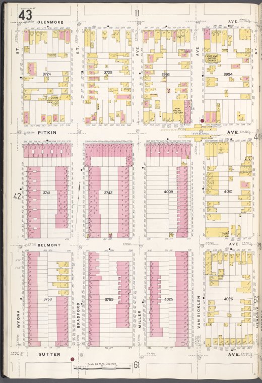
The first stop for the casual researcher will be to look up old addresses using Fire Insurance Maps from the NYPL Digital Collections. Oftentimes, as neighborhoods change, so do street numbers. Fire Insurance maps can also reveal to us what sorts of businesses and building materials existed in "yore neighborhood". Sanborn Maps Geo-Edition can help you figure out how the layout of your neighborhood has changed over time.
Additionally, NYPL has expanded remote access to key e-resources for the duration of branch closures during the coronavirus. So why not place a cherry on top of your research looking up neighborhood stories on the Newspapers.com or Readex databases, recently made available to you at home? If you've really got the time, see who lived in these buildings by searching census records via Ancestry, also recently made available from home—census records will reveal many things about your building's past residents including their names, ages, and occupations. You can look up the census by address number by finding your census enumeration district following these steps as outlined by Phil Sutton of the Milstein Division of U.S. History, Local History & Genealogy.
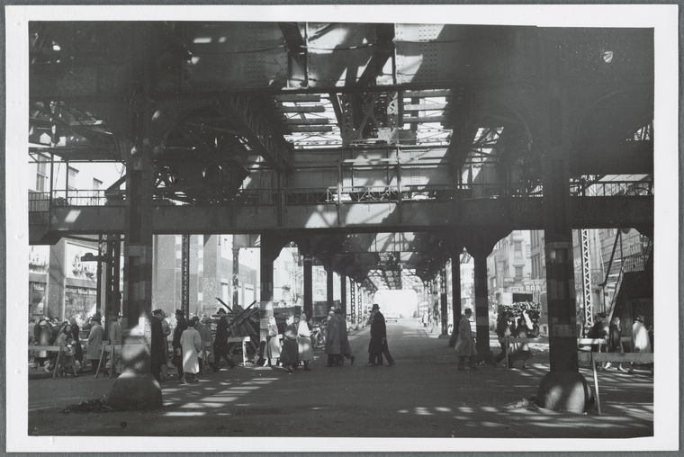
If photographs are what you're after, you may take your address numbers from the NYPL Fire Insurance maps to figure out what your neighborhood buildings looked like by perusing the NYC Department of Finance tax records from 1940 and 1980, available for all five boroughs. Searchable by address, and block and lot numbers (visit the NYC Department of Buildings website to determine block and lot numbers).
A simple example of something in my own neighborhood. See what this lot looked like in 1940, 1980, and today. Here's a very haunting one—1940, 1980, today.
While the journey of neighborhood research can be a long and arduous process, the above resources are sure to help you pass hours and hours of time…and may just lay the foundation of your new hobby. The time is now!
Read E-Books with SimplyE
 With your library card, it's easier than ever to choose from more than 300,000 e-books on SimplyE, The New York Public Library's free e-reader app. Gain access to digital resources for all ages, including e-books, audiobooks, databases, and more.
If you don’t have an NYPL library card, New York State residents can apply for a digital card online or through SimplyE (available on the App Store or Google Play).
Need more help? Read our guide to using SimplyE.
Comments
Thank you Andrew! This was a
Submitted by Amber (not verified) on April 1, 2020 - 1:10pm