Researching New York City Neighborhoods
New York City encompasses over 400 neighborhoods of varying size and structure. With notoriously murky boundaries, the city’s neighborhoods are continuously growing, declining, and resurfacing anew.
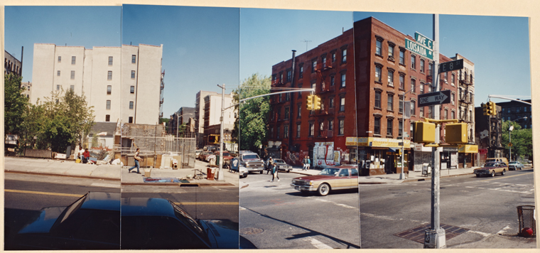
Despite the nostalgia and favoritism New Yorkers might feel for their native neighborhoods, these communities are perpetually transforming. Redefined by the city’s growth, changing populations, and the plans of real estate developers, New York City neighborhoods are ever-evolving entities.
As precursors to neighborhoods, New York first saw community distinctions in the late 17th century through the adoption of wards. Over time, residential differences began to emerge among these wards and the outwardly expanding boundaries of the city.
Many iconic neighborhoods once began as villages and towns, independent of nearby New York City. Their unique histories and identities predate their absorption into larger cities, boroughs, and eventually the greater New York City that we know today.
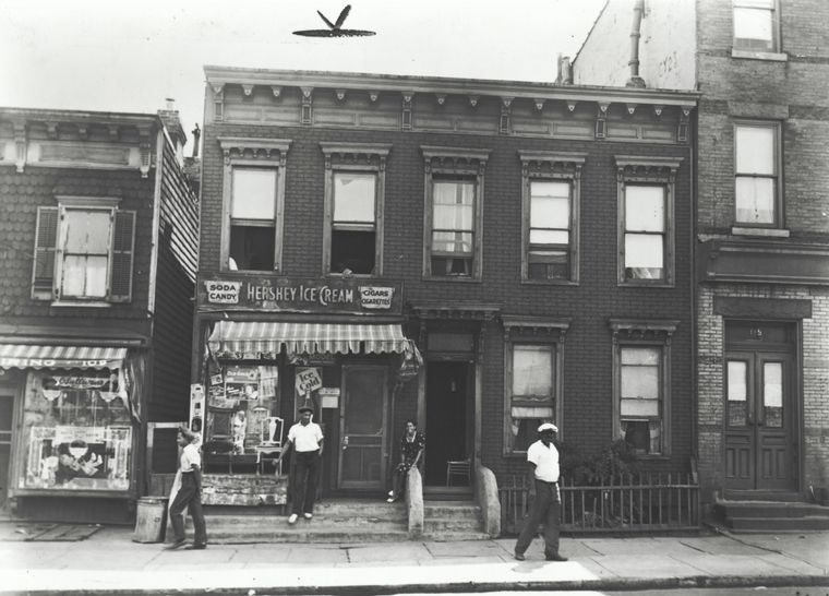
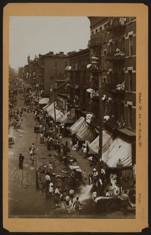
Facing increasing population growth and land development, neighborhoods came to be defined by the clustering of different ethnic, economic, and racial groups, each fostering a unique culture and community.
New York City neighborhoods, from their formation to present day, can be researched through the collections of NYPL and other institutions. Useful materials include neighborhood and borough-specific histories, NYC guidebooks, city agency reports, local newspapers, clippings, statistical data, and maps, among many other resources.
- Background Research
- Neighborhood Histories
- Historic Districts
- Maps
- Neighborhood Data
- Oral Histories
- Local Historical Societies and Organizations
Background Research
A useful resource for all NYC related topics, the Encyclopedia of New York City provides concise overviews of neighborhoods, including histories, geographic boundaries, land use and development, population details, social atmosphere, name changes, and includes suggestions for further research. The "neighborhoods" entry in this encyclopedia also provides useful information on the establishment of neighborhoods and geographic boundaries throughout New York City’s history.
The New York Family History Research Guide and Gazetteer includes background information of the formation of NYC and each of its boroughs. Featured are timelines for the settlement of towns, villages, and wards for the five boroughs, along with descriptions of neighborhood names and boundaries. Also included are notable repositories, local history collections, and resources located throughout the city.
Neighborhood Names
Because of the changing nature of neighborhoods, it is helpful to begin by researching neighborhood names. Neighborhood names often change over time, and are sometimes renamed in an effort to improve their image. E.g., Yellow Hook became Bay Ridge in 1853 to disassociate with a recent yellow fever epidemic, and Hell’s Kitchen was promoted as Clinton in the 1950s to distance itself from gang violence.
As the New York Times explains, “neighborhood names and the coining thereof is a quintessentially New York activity.” Identifying communities’ past, alternate, and collective names will expand research options and provide historical details.
The following resources also provide information on NYC name origins:
- Naming New York : Manhattan places & how they got their names
- History in asphalt : the origin of Bronx street and place names, Borough of the Bronx, New York City
- Brooklyn by name : how the neighborhoods, streets, parks, bridges, and more got their names
- Annual report of the Queens Borough Historian (with supplement: The Origin of community names in Queens Borough)
Wikipedia can also be a good starting point for neighborhood research. In addition to being a quick way to learn background information on NYC neighborhoods, articles also list references for further research. References might include resources such as newspaper and magazine articles, landmark designation reports, books, and scholarly articles. Materials referenced in Wikipedia can be searched in the library catalog and databases.
Increasingly viewed by the academic community as a useful source for background research, the library has hosted Wikipedia Edit-a-thons, including those focused on New York City topics. NYC related articles edited through these events include information on neighborhoods, historic districts, roadways, subway lines, and more.
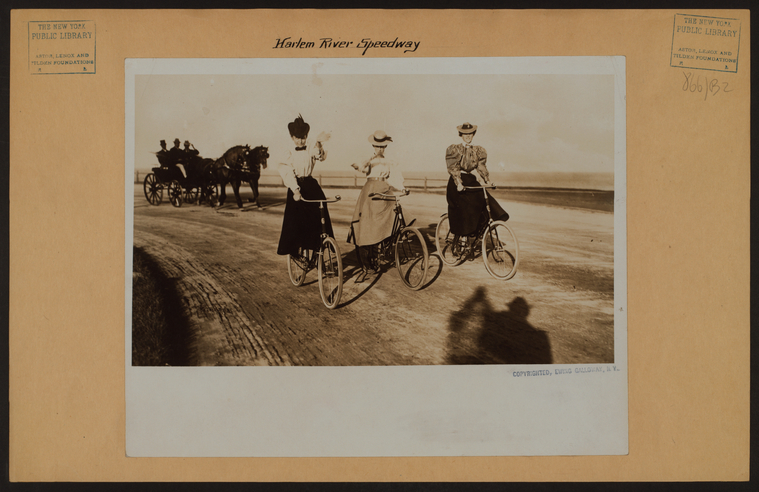
Neighborhood Histories
General histories of NYC and neighborhoods include details on the establishment of towns and cities, population growth, and how land was used and developed throughout the five boroughs. The following resources discuss the history of neighborhoods, including their foundations, cultural distinctions, geographic boundaries, and evolution within the greater context of NYC:
- Around the block : the business of a neighborhood
- The fragility of turf : the neighborhoods of New York City
- New York City : a cultural history
- New York City neighborhoods : the 18th century
- New York City, the development of the metropolis : an annotated bibliography
- The unbounded community : neighborhood life and social structure in New York City, 1830-1875
Additional resources can be found by searching the catalog for the subject, Neighborhoods -- New York (State) -- New York.
Neighborhood-Specific Resources
Search the catalog for materials which provide historical information on particular neighborhoods. Resources include both contemporary and historically written books, pamphlets, speeches, clippings, newspapers, reports by NYC agencies, interviews, archival material, and more.
Search by subject through the format: [neighborhood name] (New York, N.Y.) -- History.
e.g. Lower East Side (New York, N.Y.) -- History, Flatbush (New York, N.Y.) -- History, Jamaica (New York, N.Y.) -- History, etc.
Also search by keyword for neighborhoods’ current, former, and alternative names to locate any additional materials in the library catalog.
Borough histories may also provide information on specific towns and neighborhoods:
- Bronx (New York, N.Y.) -- History
- Brooklyn (New York, N.Y.) -- History
- Manhattan (New York, N.Y.) -- History
- Queens (New York, N.Y.) -- History
- Staten Island (New York, N.Y.) -- History
Among the neighborhood histories available in the library’s collections are the Neighborhoods of New York City series, including Brooklyn, Queens, and Harlem, and neighborhood history guides from the Brooklyn Historical Society.
New York Neighborhoods Study Guides from the library’s Teaching and Learning Division also provide teaching resources and activities for The Lower East Side and East Harlem. Included in these guides are historical overviews, activities, and questions using the library’s primary source collections.
Guidebooks
The Milstein Division’s collections include over 1,000 New York City guidebooks. These guidebooks span many neighborhoods, time periods, and topics, and provide an interesting insight into the culture of neighborhoods over time. Browse guidebooks by a particular time period using the catalog’s “Limit Sort Search" feature.
Neighborhood Land Use and Development
The library holds a variety of materials related to NYC land use, community development, and neighborhood planning. Resources include reports from the NYC Department of Planning and other city agencies. Spanning a range of years and locations throughout the city, reports and related items can be searched through the following subjects:
- Land use -- New York (State) -- New York, (Planning)
- Community development -- New York (State) -- New York, (Periodicals)
- City planning -- New York (State) -- New York -- History including (19th, 20th, and 21st centuries)
- Urban renewal -- New York (State) -- New York
Clippings Files
The collection of New York City Clippings Files contains articles from a wide variety of NYC newspapers and magazines, from the 1950s-present. For a list of NYC neighborhoods represented in these files, search the catalog for “Villages & Sections.” Also search the catalog for neighborhood names by keyword.
Local Newspapers
Local newspapers reflect the culture of specific communities and offer views of neighborhoods’ daily life and events. The following are a sampling of neighborhood newspapers available on microfilm in the Milstein Division:
- The Villager 1933-2005, “A weekly newspaper reflecting the finest traditions of Washington Square and Greenwich Village.”
- East Side News 1930-1973
- Chelsea News 1950-2006
- Co-op City Times 1969-1987
- The Parkway News 1973-1981, “Serving the Pelham Parkway/North Bronx communities”
- Manhattan East 1963-1983, "A community newspaper for residents of East Manhattan."
- A Little News 1972-1986, "From the Friends of Central Park and the Friends of Prospect Park."
Additional communities represented in the Milstein Division’s newspaper holdings include the East Village, Murray Hill, SoHo, and the West Bronx, among others. Many larger NYC newspapers are also accessible through the library. For more information on searching historical newspapers, refer to the guide: Conducting Genealogical Research Using Newspapers.

Historic Districts
Certain neighborhoods are designated as New York City historic districts. Historic districts have been deemed to hold special historical, cultural, or aesthetic value to the city, and include a collection of landmark buildings.
The Landmarks Preservation Commission issues designation reports for historic districts and landmarks, which detail their historical significance. View all NYC historic districts and landmarks, and designation their reports through the Historic Districts Council. Also locate historic districts through the Landmarks Preservation Commission, and search for designation reports through the Neighborhood Preservation Center.
The library’s collections also contain landmark designation reports and other information on NYC historic districts. Search the subject Historic districts -- New York (State) -- New York for more details. Also explore historic districts and NYC landmarks through The landmarks of New York : an illustrated record of the city's historic buildings.
To research the histories of individual buildings throughout NYC, refer to the guide: Who Lived In a House Like This? A Brief Guide to Researching the History of Your NYC Home.
Maps
Neighborhood changes such as evolving boundaries, land use, and area characteristics are often depicted through maps. The library’s Map Division (maps@nypl.org) holds a significant collection of NYC maps and atlases, from New Amsterdam to the present.
Read the following guides for more details regarding NYC map research at the library:
Digital Collections
Many maps and atlases of NYC are available through the NYPL Digital Collections. Collections include:
Catalog
Locate New York City maps through searching the catalog. Search by subject for maps of the city’s boroughs:
- Bronx (New York, N.Y.) -- Maps
- Brooklyn (New York, N.Y.) -- Maps
- Manhattan (New York, N.Y.) -- Maps
- Queens (New York, N.Y.) -- Maps
- Staten Island (New York, N.Y.) -- Maps
Search for particular neighborhoods by keyword and subject: [neighborhood name] (New York, N.Y.) -- Maps.
e.g. Williamsburg (New York, N.Y.) -- Maps, Greenwich Village (New York, N.Y.) -- Maps, Harlem (New York, N.Y.) -- Maps, etc.
Additional neighborhood maps can be found through the subject, Neighborhoods -- New York (State) -- New York -- Maps.
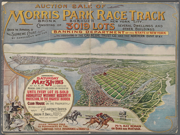
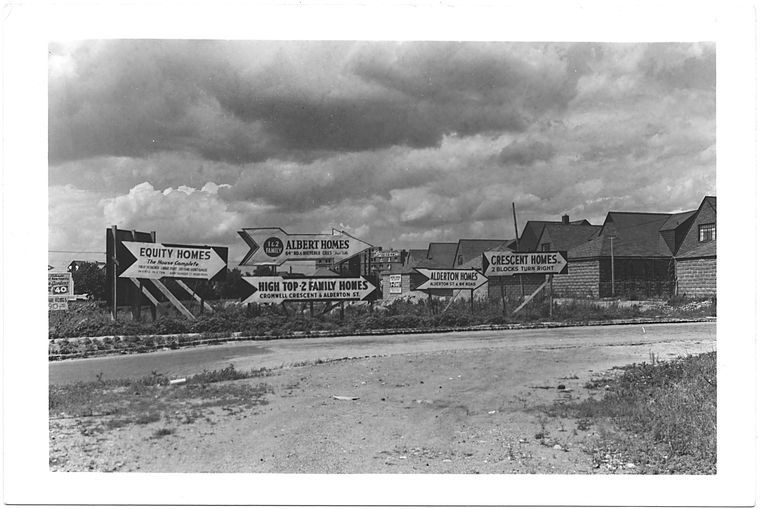
The Map Division’s Land Auction Catalogs also illustrate neighborhood development in NYC. As advertisements to auctions off the city’s undeveloped lots, these pamphlets can be used to explore changing land use in the Bronx, Manhattan, and Brooklyn from the 1860s-1920s.
More Map Resources
OASIS provides an interactive map of NYC, searchable by neighborhood, community district, zip code, and other geographic boundaries. Maps can be customized to include a variety of information, such as transit, parks, environmental characteristics, land use, social services, population, and many others.
The NYCity Map Portal can be searched by address, block and lot, or intersection for links to a variety of neighborhood information, including community district websites. The NYC Department of Planning and NYCdata also offer maps that show neighborhood boundaries.
Neighborhood Data
Because neighborhood boundaries are informally defined, the geographic boundaries for communities are determined in different ways by different sources. Use this Baruch College guide for details on how neighborhoods are defined by different city and federal agencies.
InfoShare

The InfoShare Online database, accessible at the Science, Industry and Business Library, provides census data for New York City and New York State. Data for NYC is available at the local level (e.g. community district, health district, police precinct) and includes topics such as population, immigration, land use, public assistance, and public schools among other factors. Selected neighborhoods can be profiled and compared through maps and tables.
New York City Department of Planning
The NYC Department of Planning provides a wealth of information for neighborhoods throughout the five boroughs of NYC. Explore a variety of demographic, social, economic, and housing data for recent years. Access neighborhood profiles, maps, land use data, current population statistics, future projections, and Department of Planning reports, including the NYC Census FactFinder, the American Community Survey, and the Community Portal. The Newest New Yorkers also provides neighborhood data through immigrant populations. Search the library catalog by author, New York (N.Y.). Department of City Planning, to find a variety of reports and maps from this NYC agency.
U.S. Census Bureau
American FactFinder, available through the U.S. Census Bureau, is the primary way to access data from the U.S. Census, American Community Survey, and other federal surveys. Users can focus on specific NYC locations and construct and download tables for a wide range of demographic characteristics.
NYU Furman Center

The State of the City’s Housing and Neighborhoods is an annual report by the NYU Furman Center that provides data on NYC’s housing, land use, demographics, and quality of life for the city’s five boroughs and 59 community districts. The Furman Center’s Data Search Tool allows users to create customized maps, downloadable tables, and track NYC demographic and housing trends over time. The State of the City's Housing and Neighborhood reports are also available through the library.
Center for Urban Research at the CUNY Graduate Center
The Center for Urban Research at the CUNY Graduate Center provides an archive of U.S. Census datasets and related statistical information via the CUNY Data Service. Visual representations of NYC data are also accessible through interactive maps from the CUNY Mapping Service.
For insight into NYC neighborhoods of the 1940s, explore the 1943 New York City Market Analysis. This report includes neighborhood profiles, 1940 Census data, color coded maps, photos, narratives, and borough maps and statistics.
Baruch College
NYCdata features a wide range of data related to New York City via the Baruch College Zicklin School of Business. Discover NYC statistics for topics including population, education, income, housing, social services, government, culture, sports, and more. This New York City Data research guide also highlights many different resources for obtaining NYC demographic data.
More Resources
The Citizens Housing and Planning Council’s Making Neighborhoods project illustrates neighborhood-level changes from 2000-2010 through a variety of characteristics, and includes an interactive map and detailed report.
The New York City Department of Health also provides health data and statistics for neighborhoods throughout NYC. Search the library catalog for a wide range of reports by this agency.
Oral Histories
The Community Oral History Project documents New York City neighborhood histories through the stories of people’s experiences. These interviews provide an insider’s perspective on what it was like to live in a particular neighborhood through a certain time period. Learn about the daily life, culture, and historic events as told and experienced by NYC residents from different neighborhoods and eras. These interviews are available for listening through the NYPL website and will eventually be annotated for research use.
Local Historical Societies
Search local historical societies for further collections and resources relating to NYC neighborhoods.
Five Boroughs:
- Bronx County Historical Society
- Brooklyn Historical Society
- Historic Richmond Town
- New York Historical Society
- Queens Historical Society
Local history collections at public libraries include the Brooklyn Collection of the Brooklyn Public Library and The Archives at Queens Library.
Also search for historical societies that exist for particular neighborhoods throughout NYC.
e.g., Bayside Historical Society, Kingsbridge Historical Society, Weeksville Heritage Center, etc.
Neighborhood Blogs and Websites
Search for neighborhood blogs and community associations for insight on the atmosphere, culture, and history of a particular region.
e.g. Morris Park Community Association, South Brooklyn Network, Tribeca Citizen, etc.
Many community and block associations, civic councils, neighborhood alliances, historical societies, local museums, and other societies throughout NYC are listed as neighborhood partners of the Historic Districts Council.
Also refer to Community board websites for neighborhoods throughout New York City. These portals provide information on local government issues such as land use and zoning, budgets, and public hearings, as well as background information about the community.
Photos
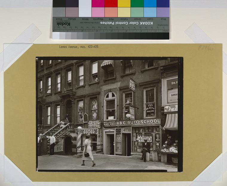
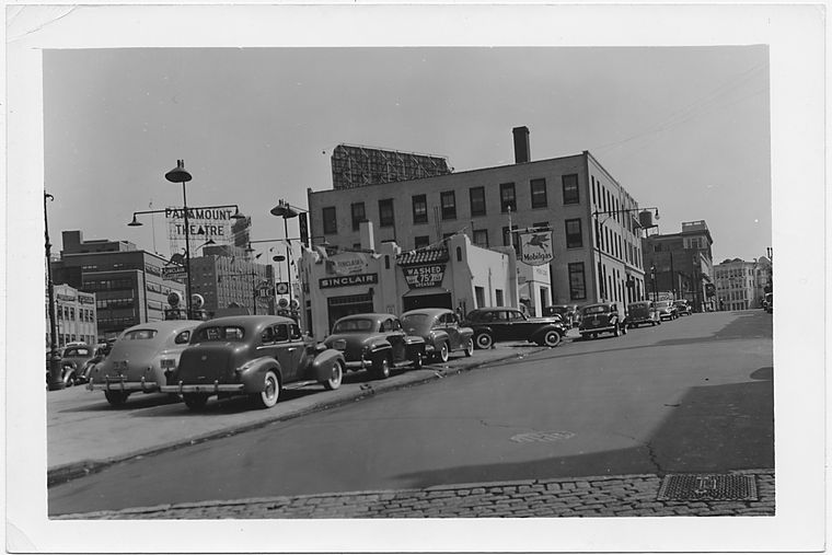
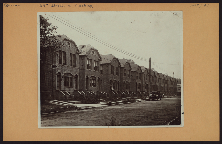
Photos of New York City neighborhoods can be found through a variety of NYPL collections. Details on locating photos can be found through the guide: How to Find Historical Photos of New York City.
Visit the Milstein Division in room 121 of the Stephen A. Schwarzman Building, or email history@nypl.org for more information on researching New York City neighborhoods.
Read E-Books with SimplyE
 With your library card, it's easier than ever to choose from more than 300,000 e-books on SimplyE, The New York Public Library's free e-reader app. Gain access to digital resources for all ages, including e-books, audiobooks, databases, and more.
If you don’t have an NYPL library card, New York State residents can apply for a digital card online or through SimplyE (available on the App Store or Google Play).
Need more help? Read our guide to using SimplyE.
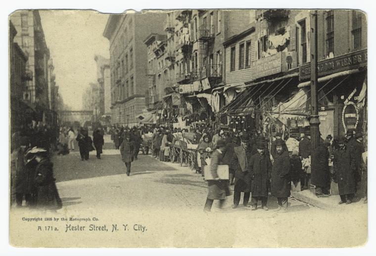
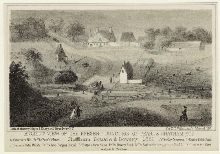
![Street scenes - A summer day on a lower east side street [in the heart of ghetto.]](https://images.nypl.org/index.php?id=733326F&t=w)
![Plate 1 [Map bounded by Liberty St., Maiden Lane, East River, Hudson River]](https://images.nypl.org/index.php?id=2021207&t=w)
![Social conditions - [New York's lower east side.]](https://images.nypl.org/index.php?id=732966F&t=w)
![Bay Street, looking North, Stapleton, Staten Island [trolley tracks, lots of people on street, horses with carriages, shops]](https://images.nypl.org/index.php?id=105075&t=w)
Comments
home of the girl group ronnettes in new york city.
Submitted by greg mccurry (not verified) on May 17, 2015 - 5:31pm
Neighborhood for 405 W 149th St.
Submitted by Megan Margino (not verified) on May 18, 2015 - 1:35pm
Chinatown
Submitted by Betty Lee Sung (not verified) on June 10, 2015 - 10:48pm
Chinatown Research
Submitted by Megan Margino on June 11, 2015 - 2:27pm
Going to live in the Waldorf Astoria
Submitted by David Israels (not verified) on June 21, 2015 - 3:49am
Ward 8, District 6
Submitted by Michael E Winters (not verified) on August 16, 2018 - 11:46am
1870s
Submitted by Marika (not verified) on January 5, 2019 - 6:58pm
Merci pour ces partages
Submitted by Patricia (not verified) on December 12, 2020 - 5:10pm